Let op: onze fysieke winkel in Elst is op vrijdag 3 januari gesloten.
- Voor 15:30 besteld, zelfde werkdag weg
- Verzending slechts € 2,95 (NL)
Fietskaart Cotswolds Cycling Map Goldeneye
Cotswolds Cycling Map Goldeneye (2024)
€ 15,90
-
Lang leve de specialist
Alles wat wij doen en verkopen is fietsvakantie-gerelateerd.
-
Fietsen maakt het hoofd leeg en het hart open
Even niet presteren. Beginnen, en de rest komt vanzelf op je af.
-
Eenvoudig gelukkig is gelukkig eenvoudig
Misschien wel de grootste rijkdom van een fietsvakantie.
Productomschrijving
Productomschrijving
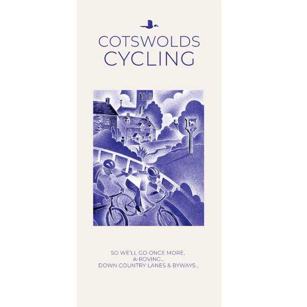
Goldeneye Cotswold - 1:100.000
Our maps are double-sided, printed on an A2 sheet with a concertina fold. This allows for easy folding and folding, and an ease of access to the mapping. The material is rain and tear-resistant. Our early maps were designed at the scale of 2 miles to 1 inch/1:126,720. The later designs along with digitalisation are 1: 100,000. We were encouraged by the Cycle Touring Club to convert our cartography toward the cycle market (to replace the out-of-print Bartholomew series). As time and the series progressed we have added more data: The National Cycle Network routes, Regional Routes, and Traffic-Free Family Routes, as and when they are developed. These routes are in addition to the Circular Routes Goldeneye Commissioned at the outset of our publishing schedule. We are also adding to new editions; bike shops, cycle hire, and tea rooms, along with the tourist attractions already featured. Our plan is to make available digital versions for cell phones and tablets and to update, on an annual basis.
National Cycle Network (NCN)
This is a linked series of traffic-free paths and traffic-calmed roads being developed across the UK linking town centres and the countryside. The so-named route numbers do not always join up as the overall planned route has not yet been completed and sometimes they overlap with other routes. sustrans.org.uk
The Cotswolds are ideal for the touring cyclist. They represent England at her very best. Long, windy lanes connect beautiful villages with excellent pubs and friendly tearooms. The landscape you cycle through is rich in imagery; rolling, “galloping country”, dry-stone walls dividing vast, sweeping sheep pastures, lazy trickling trout streams and quaint hamlets undisturbed by coach, sightseer or time. The landscape undulates, and as you reach the top of a little hill, you will rest and peer down a valley where evidence of local craftsmanship is ever present in the shape of tithe barns, churches, farms and cottages.
The twenty-eight circular routes are designed to follow the quietest country lanes and to introduce you to the best of the Cotswolds. They are only an introduction. The purists may prefer to pursue their own course. They will, we hope, enjoy and appreciate the clarity of our mapping. So free the spirit for the joy of the open road…and enjoy the Cotswolds…. Happy Cycling, Bill Trelawney
Recommended Routes/Trails
National Cycle Network (NCN)
1. NCN Route 5. Stratford-upon-Avon – Banbury – Oxford. The Traffic-Free sections run along the Oxford Waterway (see below), from Oxford to Woodstock and northwards, and a couple of short sections from Bodicote, south of Banbury (see map reference Q1).
2. NCN Route 41. Gloucester & Sharpness Canal – Bristol. The Traffic-Free section runs between Frampton-on-Severn and Slimbridge for about 6km/4 miles.
3. NCN Route 45. Gloucester – Salisbury via Stroud, Cirencester & Swindon. There remain gaps in the route. The Traffic-Free sections runs between South Cerney and Cricklade for about 10km/7 miles.
4. NCN Route 48. Northleach - Cirencester.
5. Regional Route 57. Northleach – Witney. The Traffic-Free section runs between Minster Lovell and Witney for about 5km/3 miles.
Traffic-Free Family Routes/Trails
1. Stroud Valley Cycle Trail. 15km/9.5miles. Former railway track along the Nailsworth Valley. Start at Kings Stanley car park, cross A46, to Dudbridge Roundabout and follow trail to Egypt Mill. (D8)
2. The Oxford Waterway. 15km/9.5miles. Trail along canal towpath. Best started from Wolvercote car park. Suggest you first head north towards Duke’s Lock, Kidlington Green Lock, Roundham Lock and the Jolly Boatman Inn, then onto Thrupp. Return to Wolvercote, and south to Oxford City Centre. (R7)
3. Forest of Dean Family Trail. 15km/9miles. Former mining tracks now converted into a web of criss-crossing biking trails. This circular route starts from Pedalabikeaway – Drybrook Road – Dilke Hospital – Blackpool Brook – Burnt Log – Connop Wharf with off-shoot trail to Coleford via Parkend. The routes are waymarked. A detailed map is available from the bike hire hut. Refreshments. (A6)
Hoofdkenmerken op een rij
| Schaal | 1:100.000 |
|---|---|
| Taal | Engels |
| Uitgever | Goldeneye |
| Jaar van uitgave | 2024 |
| Artikelnummer | 002584 |
| EAN / ISBN | 9781859653036 |
Reviews
Schrijf uw eigen review
Andere producten die mogelijk iets voor u zijn!