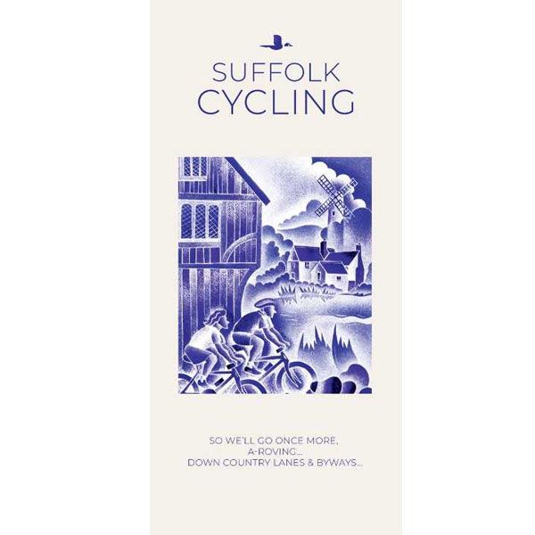
Fietskaart Suffolk, Cycling country lanes & byways
Suffolk, Cycling map (2024)
-
Lang leve de specialist
Alles wat wij doen en verkopen is fietsvakantie-gerelateerd.
-
Fietsen maakt het hoofd leeg en het hart open
Even niet presteren. Beginnen, en de rest komt vanzelf op je af.
-
Eenvoudig gelukkig is gelukkig eenvoudig
Misschien wel de grootste rijkdom van een fietsvakantie.
Productomschrijving
Productomschrijving
Suffolk Cycling Country Lanes Goldeneye 1:126.000
Our maps are double-sided, printed on an A2 sheet with a concertina fold. This allows for easy folding and folding, and an ease of access to the mapping. The material is rain and tear-resistant. Our early maps were designed at the scale of 2 miles to 1 inch/1:126,720. The later designs along with digitalisation are 1: 100,000. We were encouraged by the Cycle Touring Club to convert our cartography toward the cycle market (to replace the out-of-print Bartholomew series). As time and the series progressed we have added more data: The National Cycle Network routes, Regional Routes, and Traffic-Free Family Routes, as and when they are developed. These routes are in addition to the Circular Routes Goldeneye Commissioned at the outset of our publishing schedule. We are also adding to new editions; bike shops, cycle hire, and tea rooms, along with the tourist attractions already featured. Our plan is to make available digital versions for cell phones and tablets and to update, on an annual basis.
National Cycle Network (NCN)
This is a linked series of traffic-free paths and traffic-calmed roads being developed across the UK linking town centres and the countryside. The so-named route numbers do not always join up as the overall planned route has not yet been completed and sometimes they overlap with other routes. sustrans.org.uk
To be confronted with the variety and complexity of the cycling routes, trails and paths in Suffolk can be a bewildering experience. For it appears that the Suffolk County Council and the three District Councils are all trying hard to promote their areas. This is indeed encouraging for the growth of cycling, but it can be confusing. Our purpose is to provide clear, easy to use and easy to follow, cycling maps, and to illustrate these in a comprehensive form.
Suffolk must be one of the most charming of counties to explore by bicycle. When Al Churcher delivered his routes to us at Goldeneye we couldn’t keep him quiet, such was his enthusiasm and wonder at Suffolk’s country lanes and byways. He has cycled all over the UK, Canada, Mallorca, New Zealand and Sicily, but Suffolk remained a firm favourite.
The inland scenery is not spectacular for the county’s main glory lies with its attractive villages; the local architecture jealously preserved from modern depredation. There is an abundance of churches, ranging from the magnificence of Lavenham and Long Melford to more modest churches, but almost all have a unique feature to be proud of. The quiet countryside has been immortalised in the paintings of John Constable who lived most of his life in the Stour Valley on the Essex borders.
We hope that by following these routes your enjoyment and knowledge of this corner of England will increase one hundredfold. The purists may prefer to follow their own course. They will, we hope, enjoy and appreciate the clarity of our mapping
Recommended Routes/Trails
National Cycle Network (NCN)
The following NCN routes cross Suffolk:-
NCN Route 1. Hull to Harwich. A 370-mile route, passing Cathedral cities, towns and villages through pastoral countryside. This is the main north to south route through Suffolk, forming part of the Fakenham to Harwich cycle route. The route enters Suffolk from Essex at Stratford St Mary and passes through Hadleigh, around the north-west side of Ipswich, through Woodbridge and Halesworth, before entering Norfolk at Beccles.
NCN Route 13. This crosses Suffolk on a South to North axis via Sudbury to the pretty villages of Long Melford and Lavenham, to the market town of Bury St Edmunds, up to Thetford, and on through the Breckland landscape to Fakenham in Norfolk.
NCN Route 51. This route forms part of the Oxford to Felixstowe Cycle Route. In Suffolk the route takes you from pebbled beaches to country parks, and from urban docks, to rural lanes. Twenty five percent is off-road. It enters Suffolk from Cambridgeshire, and crosses west to east, connecting Newmarket with Bury St Edmunds, Stowmarket, Ipswich and Felixstowe
Regional Routes
Regional Route/NCN 30. Known as the “Two Rivers Cycle Route” which runs along the Norfolk/Suffolk border from Lowestoft and Thetford, via Beccles and Diss.
Regional Route 41 (Suffolk Coastal Cycle Route). This route combines with NCN Route 1 to form an 88-mile circular route. Starting north of Felixstowe travelling through Orford (via the Butley Ferry), Blaxhall and Bruisyard, then south to Woodbridge returning to Felixstowe via Waldringfield. This circular route is set within the Suffolk Coast and Heaths Area of Outstanding Natural Beauty. Not illustrated on our map with RR41 to avoid confusion. But, follow NCN1 signs on this map.
Traffic-Free Family Routes/Trails
1. Alton Water Circuit. An 8.5-mile circuit. There are two routes available, the easier (A) and more challenging (B). Café/Visitor Centre/Cycle Hire. (J10)
2. Icknield Way. An ancient trackway crossing Southern England. The best linear rides through Suffolk start from Icklingham, The King’s Forest (C4), Euston (E3) and Lackford (C5).
3. The King’s Forest Rides. Two circular (mostly) off-road routes through forest, heathland and farmland. 13 miles. Cycle link to Bury Station. (D4)
4. Peddar’s Way. A challenging 46-mile route, the origin whose name is obscure, links Knettishall Heath near Thetfordwith the coast at Holme. For the most part it follows the old Roman road built to restrain the rebellious Iceni tribe. Open to cyclists, walkers and horse riders. (E1)
5. Rendlesham Cycle Trail. Two family trails start from the Forest Centre. The shorter trail, the Tang Trail, is about 6-miles. The longer, the F.I.D.O. Trail is 10-miles. The tracks are made up of gravel, grass, sand and tarmac. Nearby, in Tunstall Forest, there’s a popular Mountain Bike area. (L/M8)
6. Thetford Forest Park Cycle Trails: There are four waymarked routes: Green (family route), Blue Route, and the more challenging Red and Black routes. It encompasses a wide scope of off-road riding with links to the Peddar’s Way. Bike hire at the Forest High Lodge. (D3)
Hoofdkenmerken op een rij
| Schaal | 1:126.000 |
|---|---|
| Taal | Engels |
| Schrijver | Goldeneye |
| Uitgever | Goldeneye |
| Jaar van uitgave | 2024 |
| Artikelnummer | 002594 |
| EAN / ISBN | 9781859653050 |

