ITM Botswana & Zimbabwe
ITM Botswana & Zimbabwe !
-
Lang leve de specialist
Alles wat wij doen en verkopen is fietsvakantie-gerelateerd.
-
Fietsen maakt het hoofd leeg en het hart open
Even niet presteren. Beginnen, en de rest komt vanzelf op je af.
-
Eenvoudig gelukkig is gelukkig eenvoudig
Misschien wel de grootste rijkdom van een fietsvakantie.
Productomschrijving
Video Product
Productomschrijving
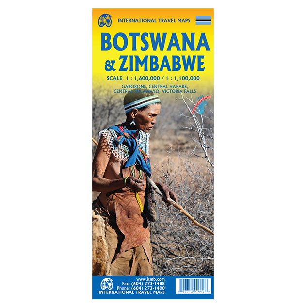
ITM Botswana & Zimbabwe - 1:1.600.000 / 1:1.100.000
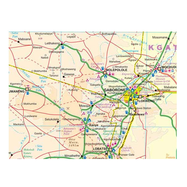
Als er voor een land of streek helemaal geen kaart meer te vinden is om te fietsen dan hebben we gelukkig altijd nog de ITM-kaarten (International Travel Map). De schaal lijkt voor de fietser te grof, er kan echter goed mee gefietst worden. Meer wegen dan op de kaart staan zijn er meestal gewoonweg niet, zelfs de dirt-roads zijn meestal nog terug te vinden. Veel kaarten zijn inmiddels waterbestendig. Hoogte wordt aangegeven middels kleurvlakken.
Over de kaart van Botswana & Zimbabwe
7th Edition 1:1,600,000/11:1,000,000 on waterproof stone paper
Both Botswana and its neighbour, Zimbabwe, form a common entity and a British heritage in Central Southern Africa, but there the resemblance ends. The Bechuana formed an alliance of sorts with the Pritish to protect them from the Boers in the then-nearby Transvaal. Upon a peaceful transition to independence as Botswana, it has evolved into a democratic and peaceful country. Zimbabwe, formerly Rhodeisa, is a failed state, although potentially, Zimbabwe could dominate tourism if governmental affairs were orderly. This map focuses on Botswana simply because that country is a beacon of orderly pleasantness in the continent; well run, routistacally well developed, with good infrastructure, and close to the game preserves of both South Africa and Zimbabwe. The map includes a large inset map of Gaborone, the capital, but most visitors fly into Maun, in the north, which is close to the country's greatest assets, the Okavango Delta, home of one of the greatest wildlife preserves on earth. Personally, I prefer the central Kalahari Desert area, because it is so unique, but wildlife viewing is the source of the country's top rating as a tourist destination. To the west is Namibia, another country that has evolved into a sensible independent country, and to the east and south is South Africa. One can enter Zimbabwe at Kazanula or at Plumtree, to visit Victoria Falls, one of the great physical attractions of Africa. The second side of our maps shows this country in great detail, and having lived in the country for several years, I can attest to its attractiveness. Inset maps of Harare, the capital, Bulawayo, Victoria Falls, and the Great Zimbabwe Ruins make this map essential for anyone visiting this country. A word of caution must be fiven here, in that the condition of many of the roads has deteriorated overtime, petrol is often unavailable, and basic foodstuffs are costly. The map has been printed on durable tear-resistant stone paper, and should outlast any visit.
Hoofdkenmerken op een rij
| Schaal | 1:1.600.000 / 1:1.100.000 |
|---|---|
| Taal | Engels |
| Uitgever | itm |
| Jaar van uitgave | 2020 |
| Artikelnummer | 536882 |
| EAN / ISBN | 9781771291002 |